 Mobile


 User Center
 My Training Class
 Feedback
Land Recovery Desertification Ecological Restoration
Our Focus
Publications
Datasets
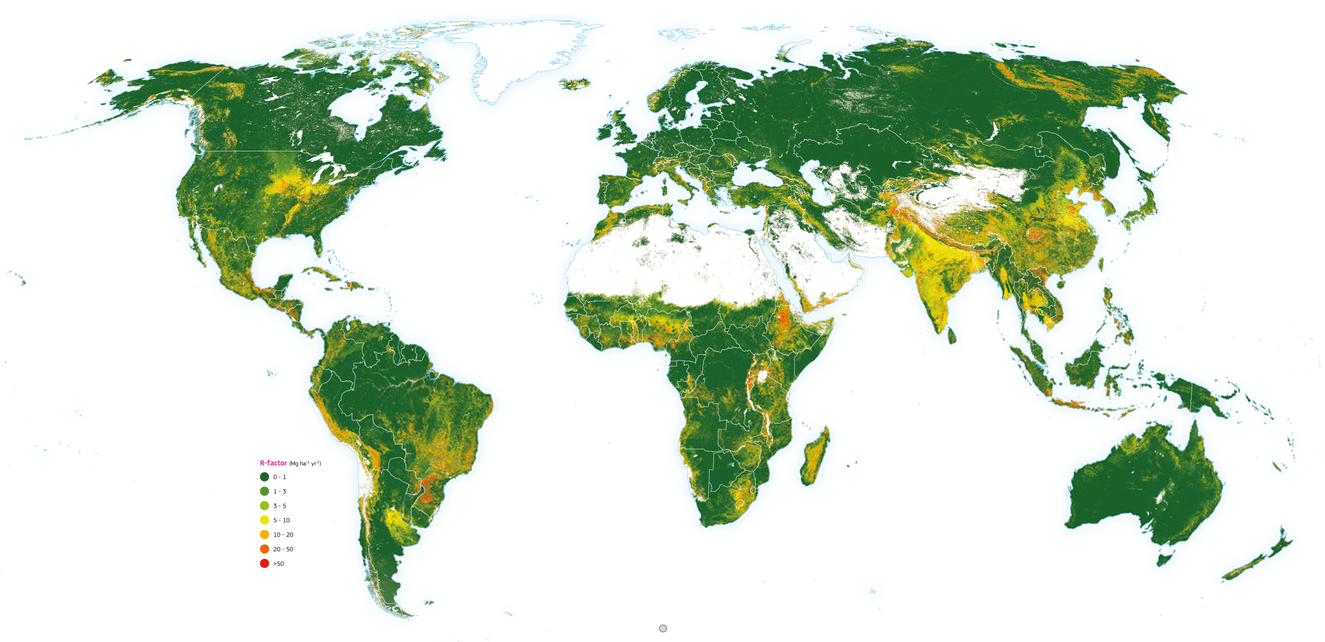
Global rates of soil displacement by water erosion
SOURCE: World Atlas of Desertification
Borelli, P. et al., 2017
The map illustrates the soil erosion rates divided into seven classes according to the European Soil Bureau classification. The colour gradation from green to red indicates the intensity of the predicted erosion rates. The baseline model predicts an annual average potential soil erosion amount of 35 Pg yr-1 for 2001, with an area-specific soil erosion average of 2.8 Mg ha-1 yr-1. In 2012, an overall increase of 2.5 % in soil erosion (35.9 Pg yr-1), driven by spatial changes of land use, was estimated. The estimates are predicted through a RUSLE-based modelling approach. The Revised Universal Soil Loss Equation (RUSLE) belongs to the detachment-limited model types, where the estimate of soil erosion (expressed as a mass of soil lost per unit area and time, Mg ha-1 yr-1) due to inter-rill and rill erosion processes is given by the multiplication of contributing factors, including rainfall erosivity, soil erodibility, slope, crop management and support practices. The model provides rates on an approximately 250 × 250 m cell basis for the land surface of 202 countries (ca. 2.89 billion cells; ~125 million km2), covering about 84.1 % of the Earth’s land. Being a global model, the map also covers areas where there is no direct anthropogenic impact.